 Robert Moskowitz, who follows matters of transportation and public policy with interest from Los Angeles, and who periodically shares with World Streets information, clues and comments on matters of old and new mobility, poses the following for our consideration this morning:
"I've noticed there's a whole infrastructure in our cities in charge of putting up stop signs, traffic lights, and the like, but no infrastructure in charge of taking them down when they've outlived their usefulness. If I were a traffic scientist, I would have studied and published on these topics. But I had no standing and no time to have more than opinions."
Reflecting on Robert's suggestion, it seems obvious that there is no possibility that any city or nation, or person for that matter, can have even a chance of moving seriously toward sustainability, without specifically reversing a lot of past decisions, investments, and physical bits, pieces and relics of everyday life.
So if that is true -- it is, isn't it? - it is something that presidents, governors, mayors and anyone else in the political establishment should be aware of and ready to engage. Anywhere on this planet. But they need to be able to point to successful examples.
That said, this is considerably more tricky than it may look at first glance. We will be giving this more attention in future articles, but the rub comes up when we contrast the manner in which many of the initial decisions and actions were taken, i.e., point decisions (example: we better put a stop sign or light there because somebody has been injured or killed), while the approach needed to rationalize the system is precisely that, systemic. This means that the "taking down" has to be worked out from an overall systemic perspective. This is possible, but unfamiliar to many transportation departments. On the other hand hugely interesting for traffic managers and transportation planners who want to put to work their full bundle of skills and tools. More to follow.
Nest step:
World Streets would very much like to invite one or more articles on anything that resembles a Take It Down Department that you might be able to point us to. It would be a great contribution.
# # #
About the writer: Robert Moskowitz is a business consultant, author, and time management "guru" who has helped develop several Internet startups, and won an Emmy for his work on a Public TV series about personal finances. He writes: "I am here cause I feel in my bones we're living profligately on the planet and we need to find a formula for establishing quality of life without destroying the environment. Obviously, sustainable development and new modes of transport are key ingredients in such a formula."
Wednesday, March 31, 2010
The Take It Down Department.
(A suggestion from one of our diligent readers)
Tuesday, March 30, 2010
Bodhisattva in the metro
 The Sanskrit term Bodhisattva is the name given to anyone who, motivated by great compassion and wisdom, has generated bodhichitta, a spontaneous wish to attain Buddhahood for the benefit of all sentient beings. What makes someone a Bodhisattva is her or his spontaneous and limitless dedication to the ultimate welfare of others.
(May we suggest that you view this at least two times? Get comfortable.)
It's not the destination, it's the voyage.
Merci Christine.
World/Streets.
# # #
Credits: The scenarist and director of "Merci" is Christine Rabette (she is the one reading the book). Produced by Patrick Quinet and Artémis Productions, Belgium - www.artemisproductions.com With the support of the Centre du Cinéma et de l'Audiovisuel de la Communauté française (CCA), Belgium -- //www.audiovisuel.cfwb.be/
------------------------------------------
Paris, Monday, 29 March 2010
PS. What is it supposed to mean?
I was afraid I might be asked this question, and indeed I have on several occasions in the last day. So in all respect let me give this a stab, although I really do hesitate because in a way I see this as an intrusion on your interpretation, which is the only one that counts. So be it.
Essentially I had three thoughts lurking at the back of my mind in wanting to share this short film with you. None of them being ha-ha jovial.
The first is that I see it as pure Zen, by which in this case I mean it is what you want it to be. If you have the patience for it (your call!), it is well done, it is about life, and it is oh so gently about people. So to me, even as a World/Streets guy, the fact that it takes place in an urban transport mode is not at all the main point. But to each of us, her/his own.
The second idea was to see if this might serve for some as a quiet, close to subliminal call to encourage us all to get comfortable with different thinking about our mission, and more generally that of planners and policy makers when faced with the challenges that World/Streets among many others attempts to address. I hope I am hurting no one's feelings greatly when I make the point that much of the work that is planned and executed in our sector all too often combines high technical virtuosity, or at least talent, with a bit too narrow vision as to what cities are all about. Too much attention given to infrastructure, and not enough to people. (Did that come across for you?)
Finally, I wanted to see if this might reinforce one of our fundamental precepts here at World/Streets, which is that we need to give more attention to happiness as a goal of our work and choices. As a reformed economist I certainly do not want to surrender all of the terrain of happiness vs. your favorite indicator to Amartya Sen and Joe Stiglitz (as per their exemplary contribution via the Commission on the Measurement of Economic Performance and Social Progress). They have helped to blaze this path, but we now need to take it further in our own work.
More happiness in transport, more happiness in cities. Tell me that this is not a noble goal?
Eric Britton
Editor, World/Streets
PS. And oh yes, tell us what you think this is all about. That's what the Comments section just below is for.
Monday, March 29, 2010
Le origini e la diffusione del car sharing in Italia
The origins and structure of Car Sharing in Italy
 With this latest report from our Italian sister publication Nuova Mobilità, we put before you our second article on the growth and status of carsharing in Italy. Italy, as you will see here, has a very different development trajectory from most of the rest of Europe or North America. What else is new? La creatività italiana
 But this time we are not going to help out with an edited version of the machine translation, rather we are going to give you the first few paragraphs of the machine translation, and then the links so that you can read the entire report in either the original Italian or what we think is a pretty good machine transition into English. If you want to know, you will know.
The origins and spread of car sharing in Italy
Editor's introduction: Today we continue our exploration of transport modes that are shared with this punctual analysis of Gian Piero di Muro on the state of the art of car sharing in Italy to complement the previous post edited by Tiziano Schiavon. Some call car sharing "the last nail in the coffin of old mobility ", since the overcoming of the transport system was born early last century can not pass through the integration of different modes of moving the car in which sharing is the natural complement to the final.
Enrico Bonfatti, Editor
- - -
Before 2000, the car sharing concept in Italy was almost totally unknown potential users, citizens in general and to supply potential of the sector, i.e. traders.
In particular, before 2002 there was only one reality, which provides the car sharing service in Milan. It was Legambiente, which in 2001 had launched the service for its members.
The greatest contribution to the development of car sharing service in Italy was provided by the initiative (ICS Car Sharing Initiative) launched by the Ministry of Environment and implemented in October 2000, in the form of an agreement between communities.
-- article continues here
# # #
* Click here to read the full Italian text - http://nuovamobilita.blogspot.com/2010/03/le-origini-e-la-diffusione-del-car.html
* And to read it in English (or other language) click to that link and in the left machine translation slot, put in the language of your choice. Buon viaggio.
Friday, March 26, 2010
Letter from Kathmandu:
Promoting walking as sustainable transport in cities

 Does anyone notice anything a bit strange in these two photos of traffic in Kathmandu Nepal on any typical day. To the left we have boiling Asia-style traffic propelling speeding high carbon males. While to the right we see a woman and a girl making their way as best they can by foot. Hmm.
Status of Pedestrian Infrastructures in Kathmandu City
- Charina Cabrido, Clean Air Initiatives for Asian Cities. Kathmandu, Nepal.
A study undertaken by Clean Air Network Nepal and Clean Energy Nepal (CEN) has revealed that pedestrian facilities in Kathmandu are in extremely poor condition and not user-friendly to physically disabled people.  The field survey was conducted in commercial, public transport, educational and residential areas covering a total of 48 road stretches with a combined length of 59 kilometers.
Based from the survey results, the walkability index of Kathmandu City is 559. When compared with other cities, Bangkok is 121. An index that comprises a single ranking number is regarded to be a more walkable city. Residential areas in Baneshwor Height, Kuleshwor, Khusibu and Lainchaur to Lazimpat has the highest walkability scores in the following variables; availability of walking paths with maintenance and cleanliness, availability of crossings per stretch, grade crossing safety, motorists obeying traffic laws and security from crime. 
The commercial area in Ason road has the lowest walkability scores in almost all variables: availability of walking paths, availability of crossings per stretch, grade crossing safety, motorists obeying traffic laws, amenities, disability infrastructures and security from crime. It was registered that significant modal conflict in walking path mainly comes from vendors occupying the footpaths that make walking inconvenient. The Public Transport areas in Ratna Park and Kalanki have the highest number of pedestrian users and obtained the highest score in walking path modal conflict.  As a first step towards encouraging and helping cities improve their pedestrian infrastructure, the Asian Development Bank through the Clean Air Initiatives for Asian Cities (CAI-Asia) and its partner network, Clean Energy Nepal (CEN) has conducted the walkability survey in Kathmandu City to collect data about the city’s pedestrian environment.
The overarching goal of the project is to improve pedestrian’s safety and mobility and promote walking as a sustainable transport. Prior to the survey, CEN conducted the walkability training in Kathmandu City last January 13 on fifteen youth volunteers known as Walkability Ambassadors. The training included a methodology in assessing the pedestrian environment based on safety and security, convenience, policy support, study area selection, city boundary, street selection, and time of day considerations.
About 305 pedestrian interviews were conducted to analyze travel behavior (time that pedestrians spend for each travel mode), pedestrian preference in terms of infrastructures, degrees of exposure to air pollution and socioeconomic profiles. Field survey forms were collected to examine road stretches around the city that includes availability of walking paths, motorist behavior, amenities, obstructions, and security from crime, among others.
When we asked pedestrians to rate the existing pedestrian facilities in the city, 46 percent said that the situation of existing infrastructures in the city is in its worst condition. There was no observed consistency in design in terms of width, height, and continuity of footpaths or road-crossings. A number of footpaths have meter width forcing the pedestrians to use the main roads. Other amenities such as lamp post and greenery occupy the footpaths and existing guard rails are in poor state. Pedestrian signboards and crossing marks are fading that gives longer waiting time for people to cross the other side of the road.
About 94 percent of all the surveyed road stretches has no existing facilities for persons with disabilities. In terms of improvements in pedestrian facilities, this is the utmost priority perceived by majority of the respondents, followed by improved street lighting and wider, level and clean sidewalks.
Almost 80 percent of the stakeholders and government respondents said that there are no clear laws on jaywalking, traffic calming and roadside advertisements. The Metropolitan Traffic Police claims that traffic enforcement is regularly being implemented. However, their data reveals that the total accident for the year 2065 to 2066 (Nepali Calendars) accounts for 2765 in which the total fatality is 137; the total number of seriously injured is 720 and minor injuries reported is 2448. Based from the results derived from stakeholder and government surveys, the main barriers in improving the pedestrian facilities include lack of awareness on the importance of pedestrians safety, polices and investment for pedestrian friendly infrastructures and guidelines, linkages of all authorities working on pedestrian issues, poor urbanization plan and weak agency implementation.
The strength of a city’s pedestrian network affects the overall pedestrian experience. In most countries advocating sustainable modes of urban transport, the methods of planning are redesigned so that these are integral part of the sustainable transport planning. Priorities are shifting towards less environmentally damaging modes and improved vehicle technology and optimizing the use of existing capacity
As a way forward, CEN wants to disseminate the results of the walkability survey in Kathmandu City and work on an integrated approach towards sustainable urban transport in the city. Beginning third week of March, various activities are scheduled as follows: Youth sharing sessions with students, Cycling Marathon, Training on UNEP Toolkit for Vehicle Emission Testing and discussion with the Kathmandu Metropolitan City, Ministry of the Environment, Ministry of Physical Planning and Works and other concerned officials regarding planned initiatives in encouraging people to travel on foot. CEN believes that improving the pedestrian facilities has many societal benefits. More often than not, the environmental, social and economic development of the city is entirely dependent on safeguarding the key pedestrian routes.
# # #
About the author:
Charina Cabrido is an environmental researcher, a writer and a cycling advocate who  is working for sustainable urban transport in Kathmandu, Nepal. She is currently associated with the Clean Air Initiatives for Asian Cities, an organization that is active in 8 country networks and over 170 organizational members to promote and demonstrate innovative ways to improve the air quality in Asian cities through partnerships and sharing experiences. Charina currently leads the Walkability Index Survey in Kathmandu to promote improvements in pedestrianisation infrastructures and services. She is also active in developing mass education, awarness and media campaign related to Air Quality Management issues in Nepal through the Clean Air Network Nepal.
Editor's note:
Sometimes life is simple. If you want truly sustainable transport system, design it for females. All the rest will be fine tuning.
And don't worry. We will not stop repeating it.
Eric Britton, World Streets
Thursday, March 25, 2010
How to build more traffic? It's not hard. Read on.
A bit down on the resource column just to your left is an early warning system of sorts which calls up relevant articles from an eclectic collection of independent sources that publish regularly in areas related to our field. One of these is Planetizen, where yesterday we spotted this thoughtful interview we thought  you might wish to check out. It's an old story, but good research helps us to get beyond the purely anecdotal. And now that we know it, the job is to get that message across where it counts.
Freeways Responsible For Emptying Out Cities
- Interview by Tim Halbur, managing editor of Planetizen
A recent study shows that for every significant freeway that gets built in a major city, population declines by about 18%. Nathaniel Baum-Snow, author of the study, talks with Planetizen.  Nathaniel Baum-Snow is a professor of economics at Brown University. His research has been remarkable consistent and urban-centric since writing his dissertation in 2000 on "The Effects of New Public Projects to Expand Urban Rail Transit." Baum-Snow’s work came to our attention when he was cited in a recent Boston Globe article quoting his study that concluded that each new federally-funded highway passing through a central city "reduces its population by about 18 percent." The implication of this type of data-driven evidence of the effect of highway construction on cities is often hard to find, so we went to the source.
BAUM-SNOW: There’s a lot of anecdotal evidence we see out there in metropolitan cities that a lot of jobs exist in the suburbs, and that that wasn’t nearly as true 40 or 50 years from now. But amazingly enough, there’s not a lot of systematic, empirical evidence about the extent of which that employment decentralization has occurred, and their isn’t a lot of empirical evidence about how commutes have changed over time. In the process of writing my first paper about highways and suburbanization, I tried to read everything I could about this and I couldn’t find anybody who’d looked at this in a systematic way across metropolitan areas.
And it turns out that not only has the nature of residential and employment locations have changed dramatically, but the nature of commuting patterns have also changed dramatically. Now, the vast majority of commutes do not involve the central city at all, even commutes made by people who live in metropolitan areas, whereas in 1960, the majority certainly involved central cities either as origins or destinations or both. And that’s a major change. I think the next step is to try to understand all the things that generated that change.
PLANETIZEN: Over the last couple of decades, planners have shifted their attention to thinking about regional planning. It seems to me that your research could indicate that regional planning is unnecessary, because people tend to live and work in their own locality. Is that your take?
BAUM-SNOW: Actually, I think it’s an argument in favor of having more regional land use and transportation planning, and the reason is that if suburb A builds a highway to connect to suburb B, that's going to effect the distribution of commutes not only between those suburbs but also the commutes in the region as a whole. So there are going to be these externalities where someone in suburb C has a faster way to get to work, so they're going to start using it and filling up this new highway. And a business downtown might say, hey, there's this new infrastructure, let's go locate out there and I can have a lot more space to work with. So anytime one part of a region changes something, it’s going to effect population and employment throughout the metropolitan area. So I think it's important to engage at the regional level.
I think that zoning and densification are important. But there's no way to make people or firms locate in a densely packed manner without providing the transportation infrastructure to allow them to do it. So you have to have some sort of policy at the metropolitan area-level. And what you can get is local communities imposing costs on everybody else by doing something like imposing big exclusionary zoning right next to the urban core. And that's clearly not economically efficient for the region as a whole- they're obviously trying to protect their housing values. So I think that it's important for regional government to be proactive and realistic with transportation planning.
Everybody would like to live in a dense neighborhood as long as they have the biggest house on the block. So they have a lot of living space, but their neighbors are all contributing to the sidewalk life. There's a balance there that is hard to get around, so there is a role for zoning that encourages density and gets the transportation infrastructure set up in a way that is feasible. 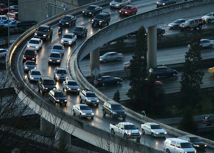
Image courtesy of Flickr user jbrownell.
PLANETIZEN: So was the creation of the highway system a good thing overall or a bad thing?
BAUM-SNOW: I do think that there was a welfare benefit from highway construction for a lot of people. People get to live in bigger homes, they have more choice in where they'd like to live. Now most households are dual-worker households, which wasn't true back in 1950. Highways have allowed two people living in the same house to commute to different areas each day, so I think there's been a welfare gain from that. So it's sort of a mixed bag, but I think most people would say that although there have been some costs, the highway system has been a good thing.
A lot of people think that decentralization is about fleeing to the suburbs out of central cities, but if you look at the change in the spatial distribution of the population across large metropolitan areas, you find that it’s really much more of a spatial phenomenon. You see that the population density in the more peripheral regions of central cities actually went up quite a bit over the last 50 years, while the population of the central business districts went down.
PLANETIZEN: And how did you, as an economist, get interested in issues of transportation and land use planning?
BAUM-SNOW: Growing up I'd always been interested in urban transportation. I always loved riding the subway, and one of the first puzzles my parents gave me as a kid was a puzzle map of the United States with all the states and the interstate highways. And I would memorize the subway maps and bus maps, stuff like that. So it was always something I liked.
And as I got older, I would explore different neighborhoods in Boston (where I grew up), and I was fascinated how you could have such heterogeneity in land use patterns and in socio-demographic patterns within such a small space. So in college, I wasn't sure what I wanted to do, but I had an interest in public policy and politics, and I took a lot of different classes. Economics struck me as a field that had the best hope in helping me think about all of these things in a satisfying way.
# # #
Nathaniel Baum-Snow is an assistant professor of economics at Brown University. You can access his research papers at his website here.
About the author:
Tim Halbur is managing editor of Planetizen,  the leading news and information source for the urban planning, design and development community. Tim is the co-author of Planetizen's Insiders' Guide to Careers in Urban Planning and Where Things Are, From Near to Far, a book for children about city planners and what they do. He is also an audio producer and artist, collaborating with artists Amy Balkin and Kim Stringfellow on Invisible 5, a self-guided critical audio tour along Interstate 5 between San Francisco and Los Angeles engaging with issues of environmental racism.
Wednesday, March 24, 2010
Car Sharing in Sweden in 2010
Carsharing is one of those areas of sustainable transport where people really know what they are dong. There is plenty of theory behind it but to get the job done one  needs to be on top of the details and active on the ground -- whether at the level of the operators or start-us, or for those rare public officials who understand their importance and get invovled, at the level of the city and more broadly. Given this, it is a miracle that we are able to get our any of busy colleagues to take the time away from their pressing responsibilities to share with us all their understanding and vision of carsharing in their country. This latest country survey provides excellent coverage of the situation in Sweden, thanks to Per Schillander of the SRA.
CAR SHARING IN SWEDEN, MARCH 2010
This is a basic description of Car Sharing in Sweden in 2010, as it appears in the SRA approach*.
STATUS IN SWEDEN
Developments in Sweden lagged a few years after the pioneering countries. Today the situation is similar for car share organizations (CSO) in many countries, with an increasingly self-sustaining and stable commercial car share industry and a number of smaller CSOs, run by local associations.
In Sweden there are currently two major commercial car share contractors, City Car Club and SunFleet Carsharing. Over the past year we have seen Bilpoolen.se and Ekobilpool appear as small competitors in Stockholm. While the two big handle about 150 and 300 vehicles respectively, the new ones only a handful of cars. Moreover, there are some small pilot projects for electric vehicles in a car share organization.
The local association car share groups are more, about 40, but deals in total with about 150 cars. Most have no ambition to grow and is unlikely to play any significant role in the continued development. The exceptions are in the current situation of Gothenburg car coop with 35 cars and Stockholm car share and Lund car share with a dozen cars each. These three have, together with a couple of other (big) car share organizations in the Nordic countries, a common reservation system and see themselves as major stakeholders in a future, bigger and more niched market. The same reservation system is also used by SunFleet Carsharing, which opens for an operational partnership. Possibly several small CSOs will change direction and move towards a more proactive role on a local market.
Besides these two types of open/public car share organizations are, at businesses and public administrations, a widespread and growing numbers of closed fleets. The workplace has a number of vehicles for official business and these, in varying degrees, are run like a car share operation.
A wide range of local governments have, supported by SRA, introduced internal car share organizations and thus increased the efficiency of their vehicle handling. A dozen public administrations (municipalities, provincial governments etc.) have taken a step further and procured the car share service by an external provider – any of the above mentioned. The latter is also an opportunity to open the fleet for businesses and the public – a development that benefits all parties and that the SRA supports.
The possibility of opening the CSO for multiple customers is often the main arguments for the tendering of the service. It is worth noting that these procurements of fleets stand for the largest growth in the industry. The picture below illustrate a desirable evolution in how a company or organization looks upon and deals with their cars and car travel. On the lowest level, they don’t really care. As climbing up the following stairs they develop a greater amount of responsibility, accurate monitoring and higher qualities. The “final stair” I reached when the company procures an open CSO, sharing the vehicles with others in the city.
In addition to its own public procurement several players act for more car sharing. Skåne Sustainable Mobility, Sustainable Travel in the Umeå region, and the county associations in Dalarna, Örebro, Östergötland and Västra Götaland are some active regional partners. Efforts are also made in several places linking car sharing with public transport. Practical collaborations are still only running in Gothenburg and Stockholm.
The website http://www.bilpool.nu, run by SNA, had the last year a significantly better appearance and function. Its main function is to show where the country's shared cars are stationed. Despite the relatively anonymous existence it is already a rather well-attended site and raises the interest for cooperation in our major cities. The page is also useful for capturing the general issues of and interest in car sharing. On the page is also available the published statistics for car share organizations in Sweden 2009.

TECHNICAL PLATFORM
Car share organizations with more than 10-20 cars, free resources by installing an administrative support system. The development of telematics for car sharing has been a major issue throughout the 1990s. Administrative support is no longer a critical success factor, but more of an obvious prerequisite for the rational operation of shared fleets. Telematics has also gone from being a purely administrative system, with reservation, logbook and recordings reported back, to now be strategic telematic platforms, with a wide range of applications. Driving behavior, alcohol interlocks, speed record, seat belt use, access, service, track & trace and damage reporting are just some of the functions that can be activated with the new platforms. In this area the operation needs to some extent coincides with the rental car business and many professional services.
ASSUMED FURTHER DEVELOPMENT
The rental car industry has for years remained at a safe distance from the “nonprofit colored” and a bit "suspicious" car share industry. Some attempts on their part went less well, but now several major players in the rental car industry have launched its own car share concept. Probably, they see opportunities to streamline their core business while broadening service offerings. With such appearances business might grow significantly. SunFleet Carsharing, owned by Hertz, are after many tough years now showing profit, which should interest the rental car industry.
The development of the car share telematic platforms will likely be coordinated with other developments in other parts of the car manufacturing industry. Most of the features offered by the mentioned telematic platforms will probably be standard features and which can be activated if wanted (and for a fee).
The trend towards greater accountability (e.g., CSR) and a higher degree of quality assurance (including transport) is likely to increase the interest of outsourcing car fleets. This is a development that SRA strongly applaud and support.
One of the main characteristics of CSOs is to free space. (Each shared car replaces an average of five private cars.) As the CSOs grow the need to support their growth and to manage their impact in the physical planning will increase. Part of the issue is to adjust the municipal parking standards down - a job that pays some attention. For some years, there is also a discussion about how to allocate parking spaces for shared cars. An interesting solution is the redistribution of street space into property space and to reserve it for car share vehicles. Car share organizations are inherently flexible and another challenge is to manage a changing need of parking spaces.
Cooperation between car share organizations and public transport is often portrayed, and rightly so, as a critical success factor for both parties. Since 2008, the regional public transport company Västtrafik and the two dominant CSOs in Gothenburg have a cooperation agreement. The agreement says that if you have a seasonal subscription card of Västtrafik you may join the CSO for three months without the monthly fee. The first two months these CSOs got a couple of hundred new customers.
The local and regional public transport companies in Stockholm and Skåne have so far shown a rather cautious interest in the issue, but we will certainly see more of this type of "free" collaboration in the future. Recently, similar collaborations started in Umeå. More integrated transport (public transport, car sharing, taxi, etc. on the same card) has been tested in many places and will perhaps also established in Sweden. In some places in Germany public transport provides a complete service, including car sharing.

CRITICAL TASKS
* Address the ability to allocate parking in streets to shared cars. The last completed national parking study, although SRA reminders, did not propose this change in focus. The ability to act through local “space planning acts” should be examined.
* Address the differences in the rules for VAT deduction. For leased cars and taxis, customer may deduct all VAT, for hired cars and shared cars, however, only half the amount of VAT. To get the car rental industry into the car share business and to attract more car sharing procured in the public sector, the rules must be assimilated.
* Continue to propagate for car sharing as a key factor for flexible travel in cities. Inform municipalities, counties and companies about the benefits of organizing their transportation needs with car sharing and public transportation. Explain the system benefits of open car share organizations that serve a variety of partners in the city.
* There is a significant gap between the market potential, awareness and appreciation and use of car sharing. Probably, there is significant potential to capture through more active marketing, such as the site www.bilpool.nu.
* SRA should continue to conduct national monitoring (statistics) and analysis of the car sharing market. SRA should also continue to act as a national and international party and interface for car sharing * Continue to gather knowledge about car sharing. The following ingredients are present for a publication:
• domestic market potential (completed January 2009)
• status in the world – a list and fuller description
• status in Sweden – list and fuller description
• VAT – rules of deduction and tax rates for car sharing
• public transport – new models, strategies
• extended functions – speed and fuel record, alcohol interlocks, etc.
• procurement requirements – optimized solutions
• key figures for enterprises and organizations
• review of administrative systems (from 2008)
• parking - utilities, standards, policies
# # #
Note:
April 1, 2010 marks the start of a new governmental authority – The Swedish Transport Administration. The new administration is charged with the task of developing an effective and sustainable transport system including all modes of transport. In close dialogue with regions and municipalities, the new Transport Administration is responsible for the collective, long-term infrastructural planning for all modes of transport. The Transport Administration is also responsible for building and maintaining the national highways, roads, and railways. In addition, the Transport Administration is responsible for efficient use of the infrastructure and for promoting safe and environmentally adapted transports.
About the author:
Per Schillander: Master of science, 30 years of experiences in different tasks in  environment and transport areas. Employed by the Swedish road administration since 1998, as a small part national expert on car sharing. All year cyclist (southern Sweden). Big lover of music, sailing, wildlife etc. A never resting improver of house, garden, mind and society.
![]() Back to top
Back to top
Honk! Any idea what this might be?
 Whatever it might be there seems to a lot of it apparently going on in various places around Europe -- or at least that is what this map seems to suggest. But what exactly is it? Where do you go to find more? Stay tuned. We will be looking at this in the days ahead together with the team that is drawing this map.
Well here it is a bit larger so that at least you can start to read the legends. (And if you click the map you get an even larger, clearer image.)
What if we take a look at the above and contrast it with the map we get showing the locations of the last 80 origins of people who visited World Streets this afternoon. Do we see a pattern, no matter how rough? Hmm.
Let's leave it at that for today since the team behind the project is not quite ready to maek their formal anouncement with the full story and the ready to use toolset. But soon. We'll stay right on it.
In the meantime conjectures, and even information, are welcome.
Tuesday, March 23, 2010
Learning from each other: New York looks at London
(So who are you looking at?)
 We started World Series last year not because we felt that we were going to tell you everything you need to know about sustainable transportation, but rather to offer you a lively independent platform with worldwide coverage in which all of those of us were concerned with these issues can exchange ideas and commentaries freely. Here is a good example of a shared learning process that does not have to stop with the two cities directly involved in this report.
 How London Is Saving Lives With 20 MPH Zones
- Noah Kazis reports from New York.
When Mayor Bloomberg announced that the new pedestrian spaces in Midtown are here to stay, he made special note of the safety improvements on Broadway, which he called "reason enough to make this permanent." And after the mayor told reporters that the city was getting lots of requests for similar livable streets treatments, the speculation started: What's next?
To replicate the Midtown street safety benefits throughout the five  boroughs, New York could look to the example of the UK, where 20 mph zones have reduced automobile speeds across the country.
The global city that perhaps most closely resembles NYC -- London -- has been installing 20 mph zones for the last decade, and they are saving lives. Already, 27 fewer Londoners are killed or seriously injured each year because of them.
The standard speed limit in London, as in New York, is 30 mph. Since 2001, however, London has built more than four hundred 20 mph zones, as described in a 2009 report by the London Assembly [PDF]. The zones are located in residential neighborhoods or near areas of high pedestrian activity, like schools. As of last year, they covered 11 percent of the total road length of the city.
The safety effects of the 20 mph zones have been enormous for pedestrians, cyclists, and drivers alike. In London, serious traffic injuries and fatalities have fallen by 46 percent within the zones, according to the prestigious British Medical Journal. Deaths and serious injuries sustained by children have dropped 50 percent. There's even a small spillover effect, with areas immediately adjacent to 20 mph zones seeing an eight percent reduction in total injuries and deaths. The science is so clear that in 2004 the World Health Organization endorsed 20 mph speeds as an essential strategy to save lives.
These 20 mph zones do much more than change a digit on speed limit signs. London's zones include a host of traffic calming measures to make the speed limit self-enforcing: road humps, raised junctions, chicanes, and raised crosswalks are the most common. Increasingly, speed cameras are used to enforce lower speeds.
When paired with hard hitting public service announcements like these, London is addressing each of the three E's of traffic safety: engineering, enforcement, and education. As a result, the 20 mph zones really work, silencing skeptics who claimed that Londoners would just keep driving as they always had. As implemented, overall speeds in London's 20 mph zones have decreased by nine miles per hour, according to the London Assembly report. Transport for London recently recommended 880 more sites for the traffic-slowing treatment.
Across the UK, the last few years have seen a shift away from engineering-intensive 20 mph zones and toward blanket 20 mph speed limits. Nationally, two million people now live on streets with 20 mph speed limits.
The impetus for this strategy came from Europe, said Rod King, the director of the national 20's Plenty For Us campaign. While visiting a German town famous for its large population of cyclists, King was surprised to see that the town's bike infrastructure wasn't particularly developed. Instead, he said, "In the early 90s, they reduced the speed limit on all residential roads to 30 kilometers per hour," or 18.6 mph.
Inspired, King helped bring the idea back to the UK. After starting within the bike advocate community, the push to slow down cars quickly expanded. Advocates for pedestrian safety, public health, and even some safety-minded driving groups quickly banded together behind the idea. "It's been accelerating dramatically in the last two years," said John Whitelegg, a professor of sustainable transport and a local councillor in Lancaster.
One benefit of changing an entire city or neighborhood to 20 mph speed limits is the cost, which King says may average 50 times less than London-style 20 mph zones. Another plus is that a uniform speed limit reduces confusion over constantly changing rules.
Perhaps the most convincing argument for a blanket 20 mph speed limit is that it helps residents buy into the concept of driving more slowly. According to King, the fiercest opposition comes from those who have to drive through 20 mph speed limits but still live on fast-moving streets. "They don't own the benefits of the 20 mph zone where they live," he said, "but they still have to pay the cost." When a large contiguous area is covered by lower speed limits, it's easier for everyone to make the psychological switch to slower speeds.
Today, 20 mph streets enjoy widespread popular support. The London Assembly noted that three-quarters of UK residents favor the use of 20 mph zones, though the country strongly prefers enforcement cameras to physical calming measures.
Despite their current popularity, it wasn't easy to make 20 mph roads a reality. After a 1996 report by the national Department for Transport showed how much safer slower streets would be, it took another three years for the national government to allow local governments to reduce speed limits without explicit approval. Political opposition was often intense. Many conservatives "take the point of view that the correct approach to road safety is just for parents to teach their children correctly," said Whitelegg.
Over the last few years, however, 20 mph speed limits have been sweeping across the UK. Portsmouth recently became the first British city where every residential street has a 20 mph speed limit, and nine others have already committed themselves to doing the same, according to Whitelegg. Eight of London's 32 boroughs are moving towards a blanket 20 mph speed limit. The national Department of Transport is recommending 20 mph limits for all urban residential streets.
Over a relatively short time, a broad swath of British cities and towns accustomed to 30 mph speeds have embraced the safety and quality of life that slow streets have brought. If any big city in America is ready to follow suit, it should be New York, where more people live without cars than in London.
# # #
About the author: Noah Kazis began writing for Streetsblog in January 2010, after writing at TheCityFix DC. He is a recent graduate of Yale College, where he wrote his senior essay on the importance of social class in the politics of transportation reform in New York City. When Noah was a kid, he collected subway paraphernalia in a Vignelli-map shoebox.
Source. This article orginallyh appeared in Streetsblog on 22 March. Rrefernce: http://www.streetsblog.org/2010/03/22/how-london-is-saving-lives-with-20-mph-zones/
Note: The mentioned 46 page 2009 report by the London Assembly, "Braking point: 20mph speed limits in London" is available in PDF form here: http://www.london.gov.uk/archive/assembly/reports/transport/braking-point-20mph.pdf
Editor's note:
It has been the firm position of World Streets from the beginning that "Twenty is plenty" and that is a good idea for any and every city in the world. Maybe you remember David Levinger's good ("Honey you got to slow down".
Here are a few more past articles from Streets on slowing down more generally that you may wish to check out - http://newmobilityagenda.blogspot.com/search/label/slower.
Monday, March 22, 2010
World Streets worldwide visiting speaker series:
Fred Salvucci on a sustainable transportation policy
World Streets is, as you may have noticed, not only a daily newspaper sticking to its carefully selected topic, but also as a worldwide classroom, discussion space  and shared library. And since we have our topic and our classroom, it makes sense to open it up to visiting speakers from different parts of the world for outstanding presentations that can help us better understand our tough topic. So today in our first visiting lecturuer series we are pleased to welcome Fred Salvucci, former Secretary of Transportation for the state of Massachusetts and currently of the MIT Center for Transportation and Logistics, who shares with us his reflections on some basic truths behind sustainable transportation policy and practice.
 Transportation Policy:
Thinking Globally, Acting Locally and Walking the Talk
Fred Salvucci observes that true sustainable transport requires making more than short-term fixes. A sustainable transportation program is built upon the pyramid of three “E”s: equity, environmental benefit, and economics. Maximizing on just one of these objectives imbalances the others, and leads to unintended and undesirable results.
Lecture synopsis (from MIT site)
Why do so many sustainable transportation programs turn out, like the Alice in the Wonderland parable to lead us down unexpected paths? Fred Salvucci observes that true sustainable transport requires making more than short-term fixes. A sustainable transportation program is built upon the pyramid of three “E”s: equity, environmental benefit, and economics. Maximizing on just one of these objectives imbalances the others, and leads to unintended and undesirable results.
As a case in point, Salvucci notes that improvements in sustainable transportation can be made by either “fixing the automobile”, or by “fixing the system.” The “fixes” have included the mandate for improvement in CAFÉ standards, nationwide interest in adopting a California car standard, and the Cash for Clunkers program. These are all short-term responses as car ownership, and vehicle miles traveled continue to grow.
Salvucci views public transport as a longer-term solution, and says that the government, universities, and other large employers have an important role in terms of turning the coin and incentivizing preferred modes of transport. He suggests that government policy and tax policies need to be aligned. He notes that transit resources need to be spread out widely and not benefit just a single region or provider. The early building of the National Highway System, a federal program that touched every state, received widespread support.
Building a consensus for public transit and sustainable transportation policy is possible, just as it is “possible to sail against the wind”. The state of Massachusetts and Boston, in particular, have shown this political leadership as Boston has managed to grow economically despite forgoing new above-ground freeways. A new initiative now exists in Boston, over the next five to 10 years, as all of the major bridges across the Charles River- with the exception of one- must undergo safety repairs. There will be an estimated 20% reduction in vehicle capacity, and together these bridges carry more traffic than the Central Artery. Salvucci urged planners at MIT to think of the Charles River Crossing project as a “pattern break”- an opportunity to demonstrate more sustainable transport modes in the face of the vehicle reduction.
Boston and the MIT community have a new opportunity to undo the deeply embedded use of automobiles, provided we really believe, and wish to follow, the objectives of sustainable transportation.
(From MIT World)
# # #
About the author:
Frederick Salvucci is a Senior Lecturer at MIT Center for Transportation and Logistics. He served as transportation advisor to Boston Mayor Kevin White between 1970 and 1974, and then as Secretary of Transportation of the Commonwealth of Massachusetts under Governor Michael Dukakis between 1975 and 1978, and again from 1983 to 1990. In those roles he shaped much of the transportation planning and policy in urban Boston and Massachusetts over the past 20 years.
Editor's note:
As indicated, this is the first in what we intend to be a continuing series of outstanding video presentations which we are pleased to share with our readers and viewers in all parts of the world. We have several other presentations lined up that we shall be sharing with you in due course, but certainly no more than one a week since it does take more time than reading most of the articles. With this in mind, this is to invite you to share with us in turn your ideas about future speakers and topics. Thanks in advance for your recommendations, and of course your thoughts and comments on this and any of the future presentations. This matter of creative interactivity and peer exchanges is critical if we are to move together toward our shared goal.
Eric Britton
Friday, March 19, 2010
Message from Mumbai: Streets are for People
This post is intended as a follow-up to Erica Schlaikjer’s recent post about the new “skywalks” in Mumbai. She highlighted several common criticisms – that these elevated walkways are inaccessible for the old and the disabled, that they destroy the vibrancy of streets and that they are poor alternatives to solving the real problem: the automobile. She also suggests, though, that skywalks might bring “welcome change” for cities like Mumbai, where pedestrians walk in extremely unsafe conditions. It becomes clear from a cursory study, however, that Mumbai planners do not necessarily view skywalks as a solution for improved safety, but rather, increased pedestrian flow. The idea is to move pedestrians up and away, making room for everyone else down below, including motorists and illegal street vendors who encroach on footpaths. But to pit walkers against hawkers is to ignore the real problem. A real solution would preserve the vibrancy of Mumbai’s street-level marketplaces. Most importantly, it would be about getting pedestrians to their destinations, not about getting pedestrians off the roads so that motorists have a free pass. Hawkers Welcome A Wall Street Journal slideshow shows pictures of what’s squeezing sidewalks around western neighbourhoods in Mumbai. It has pictures of phone booths and cobbler stalls, and vendors selling coconuts, sugarcane juice and vegetables. The message is clear: street vendors refuse to budge, so the city planners are being forced to make extra space for pedestrians to move. When the problem is formulated that way, the proposed solution – an elevated walkway – seems to be the obvious solution. Indeed, this seems to be the logic behind the decision to build them. “We clear [the street vendors] and they just come back,” an MMRDA official is quoted as saying. “That’s why we thought, ‘Let’s create some additional space on the road by going elevated.’ ” It is of course true that encroachment reduces the space available for pedestrians. Debris and electrical equipment and advertisement boards placed in the middle of the sidewalk are especially dangerous (as this good professor found out — he fell on the pavement and broke six ribs while trying to step around a billboard.) But not everything that disrupts pedestrian flow is bad. Trees, for example, take up a great deal of space on already narrow footpaths. But they also provide shade, without which it is impossible to walk in the summer. Street vendors also offer crucial services to pedestrians. I have walked all my life in Indian cities, and the luxury of knowing that I can find a vendor selling something to eat or drink every hundred meters is much more important to me than having a perfectly designed footpath with no encroachments. Several commentators have stressed on this point. William Whyte – the famous chronicler of pedestrian behavior in New York – speaks of pedestrians in Tokyo being drawn to vendors even when the entire street has been opened up for walkers. Streets with shoeshine people, for example, are some of the most preferable busiest spaces. Elsewhere, Dr. Geetam Tiwari, associate professor of transport planning at the Indian Institute of Technology in Delhi, argues that “pedestrians need cobblers on the road to have their footwear fixed, just as much as car owners need tyre repair shops… All commuters need cold drinks, snacks and other services on the roadside. These services have to exist at frequent intervals, otherwise walking or bicycling would become impossible, especially in summer.” These principles are valid internationally, but they are especially applicable to India. It is also important to note that the skywalks cannot take the pedestrians everywhere. In most cases, the skywalks will serve only a fraction of the pedestrians. In West Mulund, for example, the proposed skywalk provided no connectivity to the northern portions of the locality. It was fiercely opposed by people whose livelihood depends on the vitality of neighbourhood markets and people who have little hope of improved access due to the skywalk, and eventually, the MMRDA had to cancel the project. What About Safety? In my experience, walking is not very dangerous when you are walking along the road, even if a footpath is absent. Especially in Mumbai, pedestrians have safety in numbers (watch this video of people heading into Dadar Station during rush hour — organized chaos.) Things get really risky only when pedestrians have to cross busy roads, in other words, when they have to interact with motorists. And even with a skywalk, most users will have to walk the last quarter-mile on the roads, in the midst of motorists. So the solution, then, must address the problems of pedestrians at-grade, where men returning from work can eat a vada-pav before going home for dinner, where working women can buy vegetables and look longingly at the latest fashions in sarees, and where kids can guiltily eat ice-cream. While hawkers need to be regulated, they must also be recognized as essential to Mumbai’s street-life. Views from the Street Photo by Arun Shanbhag. Photo by Sayali Santosh Kadam Photo by Kunal Bhatia. The Proposal Let’s take Mulund West as an example of a proposed skywalk project. It is a classic case of a solution being misapplied. Mulund is a largely residential suburb where the railway station is surrounded by a thriving market area. The traders were against the skywalk because they feared that it would reduce their sales. The map below shows the area served by the railway station (in brown), the market area (in red), and the proposed skywalk (in blue). Clearly, the skywalk would serve only a small portion of the community. West Mulund, Mumbai, India. Image via Google. Alternate Solution If I had to make an alternative plan for this area, I would make the market area a non-motorised zone and reserve the main approach road to the station for public transport and para-transit. I propose that during rush hour, four arterial roads from the station (shown in blue) be redesigned to allow only non-motorized vehicles, buses and auto-rickshaws (three-wheeler taxis), and four cross-streets (shown in green) be preserved for non-motorized use only. These steps would have to be complemented with improvements in outer streets, including the redesign of the footpaths, restrictions for on-street parking, and the construction of off-street parking facilities. Why would such a plan work? First, we know from experience that pedestrian-friendly streets are great for commerce. Second, it provides more opportunities for improved BRT and auto-rickshaw services for the more distant areas served by the Mulund railway station. Lastly, the most harrowing part of the daily walk suddenly becomes a lot safer and a lot more fun. For the majority of commuters in Mulund who either walk or use public transport, this would be a strong improvement. MMRDA has been proposing a single solution – a skywalk – for fifty different localities in the Mumbai metropolitan region. But even if some areas do need skywalks, other areas might have different needs. The needs of people in Andheri/Mulund are obviously different from the needs of people in Bandra. Instead of choosing a solution first and then scouting around the city for problems to solve, the planners should study the problem first and then find the best solution. Then, perhaps the “caterpillars” (as the skywalks are called) won’t have to crawl in the sky. Instead, they would be on the earth, where they belong. When we set out to lay the base for this journal in 2008, we never for a moment considered calling it "World Roads". Our focus was and is on the fact that if roads are for vehicles, streets are definitely for people. Let us have a look at what one young "lapsed engineer from India" has to say about this in the context of his home city of Mumbai, with lessons that ring just as true in places like Manhattan, Madrid, Melbourne . . . or surely your city as well.
 Creating Streets for Walkers and Hawkers


# # #
Credit: This article originally appered in The City Fix Mumbia on 10 February at http://mumbai.thecityfix.com/creating-streets-for-walkers-and-hawkers/. Kind thanks to the author and the editor for sharing.
About the author:
I'm a lapsed engineer from India who found that making cars was not as much fun as  getting rid of them. This discovery brought me to Rutgers University, where I am currently doing my masters in City and Regional Planning and assisting Voorhees Transporation Center in its research.I spend my free time listening to Indian Classical Music, playing bridge or reading one of Jane Austen's novels for the millionth time.
Thursday, March 18, 2010
Mid-week recess: STOP right now!
 The transportation sector has around for a long long time. And over all those centuries and years of heavy hurtling dangerous traffic we have learned some lessons and done some things that, well if you really think about it, do not always add up. Here is one of those old ideas that Gary Lauder, co-creator of the Socrates Society at the Aspen Institute, takes four and a half speedy minutes to demolish for us. The humble stop sign. Or in this case the humble two million dollar stop sign. Oops!
[This presentation is part of the TED "Ideas worth spreading" series. And if Gary speaks too quickly for you (he does really rattle on at quite a breathtaking pace), you always can call up sub-titles, though thus far only in Bulgarian, English, and French.]
# # #
Thanks to Robin Chase for the good heads-up on this. (Robin muses well at http://networkmusings.blogspot.com. Her latest postings regularly appear in our "Latest from the world's streets' rubric which you will see if you scroll down a bit in our left hand resource column/section here.)
Wednesday, March 17, 2010
Heritage and transport: And leadership by example?
- Simon Bishop, Delhi, India  "We’ll keep our cars thank you very much. And we shall park them where we want. And for as long as we choose to. If heritage is a barrier, let’s move it out of the way. And, by the way, what moral authority do you have to tell me otherwise?"
 “The problems of excessive traffic are crowding in upon us with desperate urgency. Unless steps are taken, the motor vehicle will defeat its own utility and bring about a disastrous degradation of the surroundings for living... Either the utility of vehicles in town will decline rapidly, or the pleasantness and safety of surroundings will deteriorate catastrophically – in all probability both will happen."
The prophetic words of Colin Buchanan in the UK 1963 “Traffic in Towns” Report are now ringing in the ears of Indian towns and cities. Drivers include; a high and fast growing urban population, rising levels of prosperity, inadequate public transit, sprawling cityscapes, and easy lines of credit. All are factors behind a growing appetite to raise status through motorcycles and cars and buy into the suburban dream waiting just round the corner. More on that at the end of the article!
The impact of growing traffic is being felt specifically on built heritage in a number of important ways. The historic centres of Indian towns and cities were not designed for motorized traffic. Streets were meant to be narrow to offer shade for all manner of pedestrian and animal traffic to go about their business without struggling too much against the extreme heat of summer. Pick up any Lonely Planet to India and you’ll find testimony that such a heritage fabric lends itself for the tourist to enjoy on foot or by bicycle. Sadly exhortations to ‘explore the old city by cycle rickshaw’ or ‘hire a bicycle to enjoy the outskirts of the town’ are fading away as pollution, noise and danger render the option unpalatable.
A perfect case in point is the system of nallahs or streams running through the city of Delhi. Built by the Tughluqs to supply the city with water nearly 1,000 years ago these nallahs or streams could be cleaned up to act as ‘greenway’ walking and cycling corridors. Just one nallah in South Delhi, for instance would link five of the seven ancient cities of Delhi, providing unrivalled access for tourists, school children, families to get in touch with the proud history of this city. Led by hungry contractors, the picture below shows what is happening in practice.
 Defence Colony Nallah ‘Before and After’, South Delhi
Not only is tourist revenue under threat, but local people are increasingly hooted at and bullied in their own backyard by motorized transport. Parks and gardens are difficult for children and the elderly to get to. Street play is hazardous between parked vehicles and erratically moving traffic. What visual and aural intrusion is doing to deter tourists from ‘Incredible India’ is one thing, but the associated levels of pollution are also damaging building fabric. In larger towns with roads over 30 metres in width, high levels of traffic are also decreasing the economic viability of heritage buildings as they become dangerous and difficult to access – witness Sabz Burj on a traffic island in Delhi.
 Traffic renders Sabz Burj inaccessible in Delhi
On a wider level whole communities living in historic enclaves are severed by wide arterial roads cutting through their heart or surrounding them from outside.
At a policy level there is a yawning gap between land use and transport planning. Delhi, the capital city of India still has no Transport Plan.
A series of exhortations in the Master Plan to build cycle tracks on all arterial roads are rarely observed and, without any network plan, those that are remain ineffective. In the absence of any multimodal plan to reduce journey distance through the application of compact, mixed land use strategies, large numbers of people are moving to greenfield apartments that can only be reached by motorbike or car. The newly opened Gurgaon Expressway from Delhi, saturated with traffic years ahead of schedule, is the result.
There are isolated examples of towns that have challenged the ‘inevitable’ threat to their heritage caused by unbridled suburbanization and motorization but only one has done this in a systematic way; linking environmental, social and economic objectives. Located near the India-Pakistan border, the Punjabi town of Fazilka removes cars from the city centre during daylight hours.
The market area was the first part of town to be made car-free. Four-wheeled vehicles are not allowed to drive in this zone during 12 daytime hours, although even then it has not yet been possible to prohibit motorcycles successfully. The Municipal Council President Anil Sethi places an emphasis on improving local transport options rather than in encouraging long distance travel. Sethi eschews overpasses and flyovers in favor of initiatives like the ‘Eco-cab’ scheme where residents can use their mobile phones to dial a cycle rickshaw to take them door-to-door. The local tea seller or shopkeeper keeps part of the telephone fee for acting as the cab controller, directing rickshaws to their customers.
 Car-Free Fazilka ©Down to Earth Magazine
Other examples of towns applying the ‘car free’ concept, although not in a holistic way like Fazilka include Nainital, Shimla and Darjeeling where cars are banned during retail hours on the main shopping streets. The concept is an in emergency response to the huge influx of tourist traffic during the summer months. This, combined with steep hillside topography constrains the movement and storage of vehicles. In Nainital a system of Eco-Cabs operates where users obtain a ticket from a booth at either end of the main street and then travel from one side of the town to the other. Challenging gradients preclude cycles or cycle rickshaws in Shimla and Darjeeling but allow for pedestrians to enjoy unfettered access to the main shopping streets.
In a sign of things to come, the Carter Road in the Bandra area of Mumbai organized its first car-free day on 21st February 2010. Forty thousand local residents and Bollywood celebrities including Priya Dutt pledged to take part whilst the area was closed off to traffic. The aim of the event was to focus people’s attention on the impact of vehicles on pollution and in inhibiting healthy living and exposure to the great outdoors.
 Car-free Carter Road, Mumbai, 21st February 2010
Perhaps the key point to make, however, is that cars are aspirational. The policy wonks who rail against the Tata Nano would be the first to scream and cry if they were asked to make sacrifices by walking or cycling to the office or using public transit. Most have chauffer driven, A/C vehicles clogging up the roads on the way to their next conference.
Go to the Habitat Centre in Delhi by cycle, home to a host of environmental and UN organizations and you will be politely waved through the service entrance and forced to face oncoming car traffic. Go to a conference by cycle and you will be waved away. When these leaders asked if they walk or cycle the inevitable answer is ‘No, it’s too dangerous.’, ‘When the roads are planned for cycles I will use one’, ‘ It’s too hot for 9 months of the year in India to cycle’. The answer is always why I can’t do something, not why I can. In fact it’s perfectly possible to cycle in the Indian Plains early in the morning or late in the day when most people commute even during the hotter months with a folded shirt in your bag, a hat on your head and a T-Shirt on your back.
# # #
About the author:
- Simon Bishop is working as a transport and environment consultant in Delhi, where  he lives with his family. In India he has worked on bus and cycling projects like the Delhi BRTand helped set up the Global Transport Knowledge Partnership. Before coming to India two years ago Simon worked in London as a planner on demand management and travel marketing schemes, receiving an award from the Mayor for "London's Most Innovative Transport Project". He authored 'The Sky's the Limit' - Policies for Sustainable Aviation' while working as a policy adviser in the Institute for Public Policy Research.

